Article content
Big campuses and bigger challenges
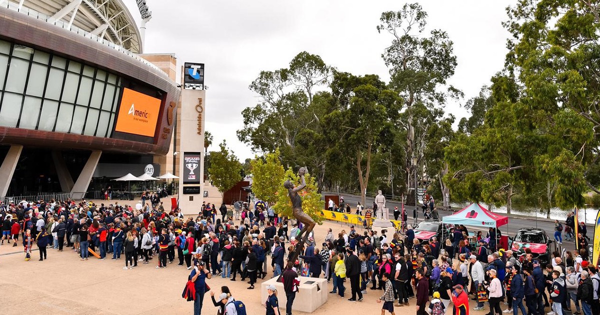
As universities develop their infrastructure and expand research and study areas, the campuses inevitably get bigger. And this could not be any truer for a university that was founded in 1890 and is Australia’s fourth oldest, the University of Tasmania (UTAS).
Owing to its expansion, UTAS has nine campuses across the state including Hobart, Launceston and Burnie. Due to the sheer nature of its size, number of buildings and people navigating through them, students found it difficult to locate buildings and classrooms, understand timetables and find public transport information. Though the university conducted several induction sessions and had frontline staff across the campus, it did little to improve the overall campus experience.
“Our objective was to offer our students, staff and visitors a world-class experience and an opportunity to familiarise themselves with our university spaces before they visit us. When our students, staff and even visitors who are in the campus to attend their classes and meetings in a building that they haven’t been in before, finding your way around could be a daunting task,” explained Nathan Tenaglia, Associate Director, Infrastructure and Operations at UTAS.
A vision to offer a better campus experience
UTAS wanted to help its new students start their university life with confidence as well as provide an exceptional campus experience for returning students, visitors, faculty, and other staff. Central to this vision was offering an easy, safe, accessible, and integrated navigation experience that removes the anxiety, confusion and stress that students feel when finding their way around the campus. The ability to locate amenities, buildings, and services available on campus was a major challenge that needed a resolution.
“Our students were provided with printed maps, however, there was no easy way to find nearest amenities, buildings and services. Generic and public web maps had limited usage in finding spaces within the campus. So, in this digital age we needed something better than the static maps,” said Nathan.
UTAS engaged Telstra Purple, Australia’s largest technology services company, to develop and deploy a digital campus navigation tool. Telstra Purple started the engagement with a design discovery phase (Purple Labs) where it facilitated a series of discovery workshops with the students and UTAS team. The objective of the Design Thinking approach was to define challenges, develop solutions, test, and validate a prototype and define a feature backlog to implement the navigation solution.
In summary, the goals to be achieved were to:
- help students navigate conveniently within UTAS,
- improve accessibility of the UTAS sites,
- improve UTAS spatial data,
- integrate with mobile apps,
- make student timetables and other public information easy to access, interpret and use,
- make the identities of spaces more meaningful for students and
- support smart campus initiatives such as space booking.
“As part of our smart campus and modern workplace vision, we wanted to connect our technology with our space. One of the key levers to achieving that is a wayfinding solution. Also, we knew from our students and staff feedback that finding their way around the campus wasn’t easy and wanted to address that situation too,” added Nathan.
More than a digital campus navigation solution
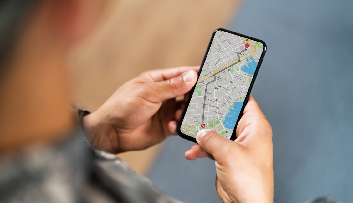
Following the design discovery phase, Telstra Purple designed, developed, and deployed a minimum viable product (MVP) version of the digital wayfinding solution – UniMaps.
This new tool has improved the navigation experience and meant students could get to their classes on time without getting lost. It helped reduce students’ anxiety and stress levels, making them feel safer and better enjoy their time at the university.
It also reduced the dependency on front line staff who would otherwise be stretched in dealing with a large volume of queries from students being unable to locate buildings or understand timetables. After the successful delivery of the UniMaps’ MVP application, Telstra Purple were further engaged to continually expand, evolve, and improve the navigation experience.
“One of the goals was to make life easier and simpler for everyone in the campus, be it students, staff or visitors. It’s important for everyone to feel safe as you can familiarise yourself with the university spaces before you arrive and know where to go to when you do,” claimed Nathan.
UniMaps does more than navigation - it surfaces possibilities as it:
- allows students, faculty staff and visitors to explore the university and all that it offers from the comfort of their own device, whether that be a mobile, tablet or desktop device.
- is embedded into the UTAS public website, UniApp mobile app, and linked to from physical QR code signage installed around the university so that ‘finding your way’ becomes an enjoyable and natural extension of the university experience.
- is integrated with UTAS Room and Desk booking systems to enable finding and booking spaces using UniMaps' web-based map interface.
UniMaps also seamlessly integrates with other applications, including:
- UTAS timetabling app
- UTAS UniApp native mobile app
- UTAS public website
- Distributed via ‘Share’ deep-links
- Available from Search Engines
- QR Codes on physical Points of Interest (POI) around campus
“UniMaps is a Web app that can be accessed on any device through web browsers by clicking on URLs or scanning the QR code. It has been integrated into our timetabling system as it was crucial for the students to find their classes conveniently and on the go. It has also given them the independence to find their way around the campus on their own,” detailed Rohani Samson, Technical Delivery Manager, Infrastructure and Operations at UTAS.
UniNav wayfinding kiosks around campus
Following the successful delivery of the UniMaps app, Telstra Purple was engaged to port the web application for use on free-standing kiosk devices with 43-inch touchscreens, known as UniNav.
UniNav features a Low/High toggle button to move the primary functionality bar of the interface to the bottom/top of the screen, allowing it to be comfortably operated by users of varying heights. Additionally, in Low mode, the main input panel on the user interface (UI) section is never more than 1200mm above the ground level as per the Australian Standards so that its accessible for users with reach limitations.
UniMaps and UniNav have provided UTAS with a branded, most familiar web maps-like custom UI that delivers a high-quality user experience. These applications have been designed with sharp contrast to ensure readability and visibility in a variety of lighting.
“UniNav is an extension of the UniMaps app optimised for use on large kiosk touch screens. Accessibility and inclusivity were crucial for delivering the best kiosk user experience as it should be as user-friendly as possible. UniNav’s user interface has been designed to cater for a diverse range of reachability, irrespective of heights, as one can choose to have the main input panel either at the bottom, by default, or move it to the top of the screen for a more flexible and improved user experience,” said Rohani.
With the help of Telstra Purple’s design, development, and delivery services, UTAS has provided two accessible, seamless and stress-free campus navigation applications that allow academics, students, staff and visitors to lead their campus life with confidence.
Delivering game changing and industry leading map-based wayfinding applications
Delivering the two digital wayfinding web-based applications was successful largely because of the agile and design-led delivery approaches used throughout the project.
Agile allowed Telstra Purple to adapt and respond to the university’s requirements and timeframes which helped to deliver multiple functionalities in an iterative approach. The design-led approach ensured a human centred design (HCD) which was inclusive for all. It also ensured that the success criteria for work was based on functionality, which was useful, usable, and intuitive to all users.
Additionally, a Learn-Build-Measure-Repeat approach meant that as the delivery progressed, whether it was user testing wireframe prototypes or specific parts of the application, the team could quickly respond to feedback and issues and continually refine to enhance and deliver high-quality applications.
“This project had to be managed dynamically as the complexity of the student feedback needed to be evaluated often; it wouldn’t have been possible without Telstra Purple,” mentioned Nathan.
As a responsive web-based application, the UniMaps design was aligned to Web Content Accessibility Guidelines (WCAG) Level AA compliant. This ensured high level of accessibility including the ability to use the application entirely with a keyboard and support for screen reader software to enable visually impaired users to interact with it.
“The Telstra Purple team was available for us throughout the engagement. They collaborated well with our team and did some incredible work in identifying the key areas of improvement. Integrating our data with UniMaps was challenging and the Telstra Purple team did an excellent job without disrupting our usual business,” concluded Nathan.
To date, four of the wayfinding kiosks are in operation and several more are planned for installation. UniMaps is now a game-changing, industry leading digital wayfinding solution which can be accessed at https://maps.utas.edu.au.
Find out more about our Telstra solutions
- Telstra Purple Software Development
- Telstra Enterprise Custom Apps
- Telstra Business Apps and Solutions Enquiry