Article content
THE CHALLENGE
Accurate and meaningful measurement of council public areas
With around 800 parks and open spaces across its local government area, Wollongong City Council faces a constant challenge to ensure these shared spaces serve the community to their best potential. Building a clear understanding of how these many, highly varied spaces are used by the public supports the council in its decisions around maintenance and development programs. But most existing measurement techniques are limited to simple traffic count data.
"I am actually from Wollongong and relocated back there in 2020,” says Iain Russell, Industry CTO State Government & Enterprise at Telstra. “I'm also an avid cyclist with a beach loving family, so I could see there was an opportunity to collaborate with Wollongong City Council, University of Wollongong and our partners to apply global digital innovation in a local context."
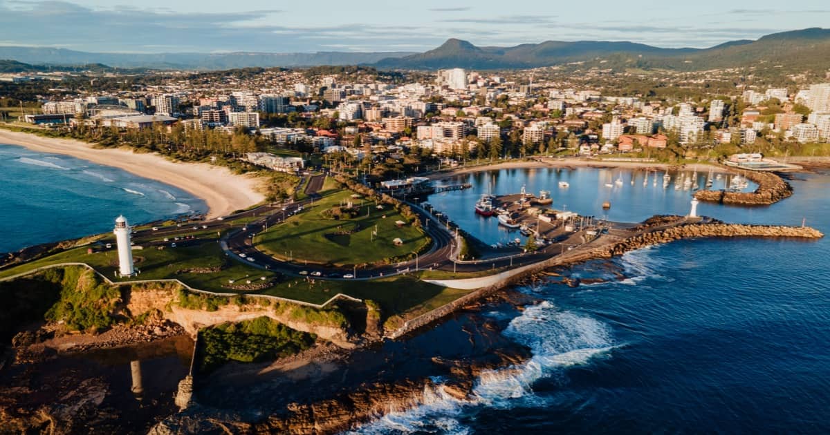
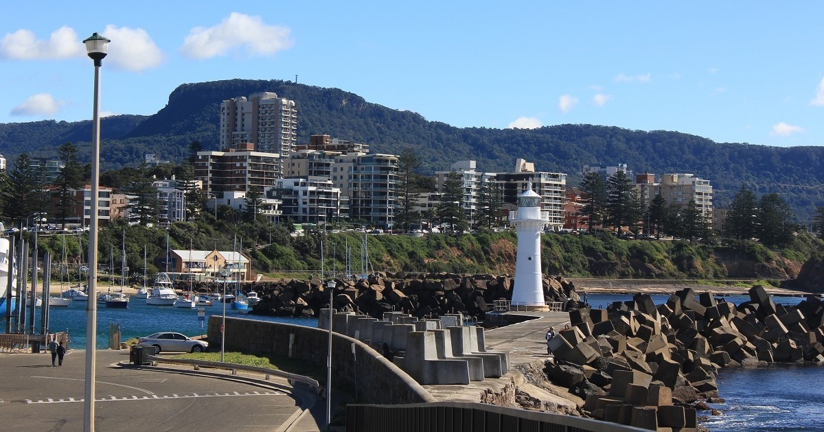
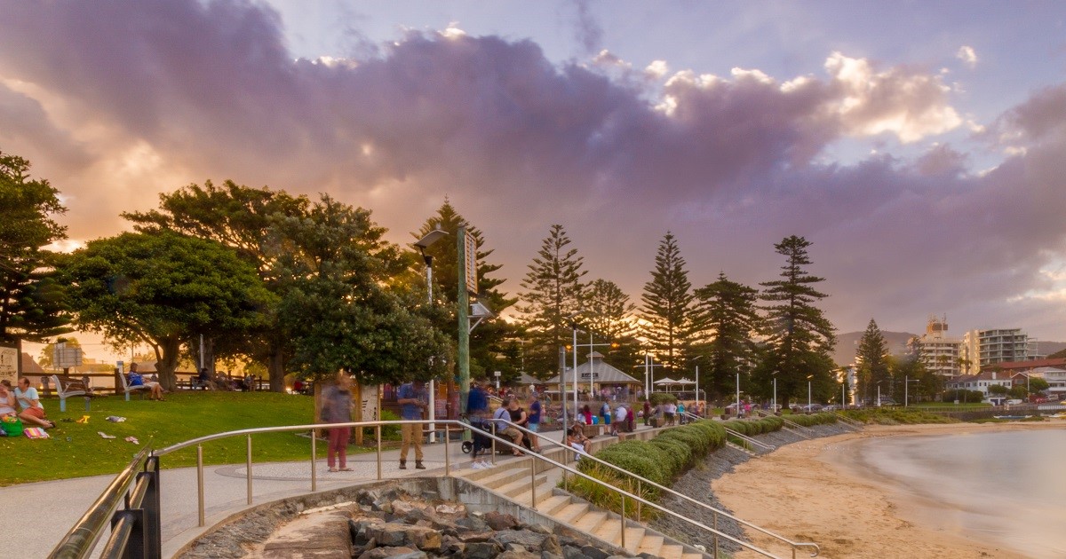
With growth in cycling activity around its hosting of the 2022 UCI World Championships, Wollongong City Council looked for new tools to accurately analyse new impacts of cycling around busy shared pathways. The Blue Mile, a coastal walkway boasting spectacular views beside the heart of Wollongong, was one of the area’s busiest shared pathways. Highly utilised by pedestrians, cyclists, and dog walkers, council receiving regular complaints about cyclist interactions with pedestrians in the area, making it a good potential test case for exploring better traffic analysis opportunities.
“We recognise that the Blue Mile is an area of concern for some community members as COVID-19 increased the numbers of people using the coastline for exercise and recreation. The aim is to provide Council with greater insights into how we can better manage the area by gaining an accurate picture of how this space is being used on a day-to-day basis.”
Gordon Bradbery AM, Lord Mayor Councillor, Wollongong City Council
Wollongong has long held a Smart City approach to using digital solutions to support its service delivery. When Telstra offered Telstra Spatial Insights, a new video analytics solution which could offer detailed insights into the movement of walkers, cyclists, and more around a target site, the council was excited to work together on the trial.
THE SOLUTION
Connecting camera data to meaningful insights
Through a series of meetings between Telstra and the Council, decisions were made to understand the council’s needs and what insights would be most useful to measure and report. Pedestrians and cyclists were seen as the primary targets, with both the number and direction of travel being monitored at the start of the trial.
“Leveraging our strategic IoT relationships with Microsoft and Nvidia for AI acceleration in hardware and software, combined with our leading mobility networks in LTE and 5G, I knew there was real opportunity to apply this technology to the issue of space utilisation on shared paths and cycleways," says Russell.
This would give council a clear understanding of how busy and potentially dangerous the traffic could be, responding to any community complaints or planning for infrastructure improvements with clear evidence.
“Telstra wasn’t just interested in giving us the technology. They really wanted to understand what we needed and how to make sure it would deliver relevant insights to the council.”
Dylan Bardsley, Smart Cities Program and Insights Coordinator, Wollongong City Council
Having chosen the Blue Mile, Telstra worked with Wollongong Council to install a camera on an existing pole in the selected area to monitor movement and utilisation for 12 months ahead of the UCI event and up to six months beyond. The camera was housed in a rugged enclosure, designed to withstand storms, hail, wind, and the harsh salty conditions of a beachside installation. The solution utilised Telstra’s leading mobile network ensuring constant and reliable connectivity at site.
“We plan to use this sensor technology to connect meaningful data that can be used to better plan our paths and recreation areas for the future,”
Gordon Bradbery AM, Lord Mayor Councillor, Wollongong City Council
As the trial progressed, additional objects such as dogs were added to the AI model via a simple remotely installed upgrade, enhancing council’s understanding of how the path was being utilised by dog walking visitors as well as other pedestrians and cyclists. Data generated by the solution was made available in the form of a web-based dashboard for Wollongong Council to explore and deep dive based on their needs.
THE APPROACH
Privacy-centred AI processed at the edge
The video analytics solution installed by Telstra Spatial Insights offers an end-to-end solution, complete with hardware, software and AI capabilities. The solution leverages GPU-based computer processing for efficient, high-performance video analytics and AI inference on site. The Telstra uplink installed with the video analytics solution operated as a two-way service, ensuring both the steady delivery of results from the video analysis as well as offering remote access for maintenance and model upgrades.
The edge AI processing is critical to delivering a truly privacy-first solution. Where a cloud-based system would need to transmit video data for analysis, Telstra Spatial Insights’ real-time analysis of live footage removes the need for video storage. Real-time footage also blurred individuals to further ensure no identifiable data was ever viewable through the system. Only the data analytics results are transmitted to the cloud, minimising data transmission and storage costs.
“Council values our community’s right to privacy. That’s why it’s important to us that the data collected is anonymous and specifically restricted to the purposes of this project.”
Gordon Bradbery AM, Lord Mayor Councillor, Wollongong City Council
Compared to traffic tubes and other video-based counting systems Wollongong City Council has used, this new Telstra Spatial Insights solution offered a unique blend of privacy-focused insights and the potential to become a more flexible, versatile form of measurement given the adaptability of the AI model for tracking different target objects.
“We have other counters where the company turned up, bolted down their counters, gave us the keys to the website, and then just walked away,” said Dr Cole Hendrigan, Senior Transport Planner at Wollongong City Council. “We’ve had many hours of interaction with the Telstra team to keep discussing how to ensure the system was helping us learn something useful.”
THE IMPACT
Flexible deployment for the data you want
As a proof of concept, the Telstra Spatial Insights solution helped Wollongong City Council understand the nature of traffic flow and direction at the Blue Mile site and trends over time for pedestrians and cyclists. As a high traffic location that received many queries from area residents about pedestrian and cyclist interactions, the council could now respond with clear data on utilisation and whether concerns were justified.
“The data we got from this showed us there were typically only 6-8% of people using this area that were cycling, with the occasional cyclist casually observed going through the Blue Mile too fast,” said Dr Hendrigan. “It’s good to have that number and to be able to respond to queries with data.”
In the context of the 2022 UCI event, the data demonstrated an increase in cycling activity in the lead up to the event, as well as a sustained increase of cycling after the UCI event had concluded. Other questions from the public included concerns about dog walkers in the area not cleaning up after their dogs. The addition of dog detection clarified the busiest periods for dog walking – and when such issues were most likely to occur.
Wollongong City Council found the trial pointed to a significant opportunity with AI-powered computer vision IoT technology, with discussions exploring adding metrics such as speed of travel and dwell time to the system. Newer vehicles such as e-scooters or monitoring wildlife movements through the area could easily be added to the existing solution through AI model updates, allowing for more robust data and analytics from the same hardware.
The trial has also led Telstra to continue to develop how this AI video analytics system can be deployed in future, with discussions between the council and Telstra leading to new features and enhancements. For example, using solar to power the device, allowing for more flexibility and installation of thwe solution in a wider range of scenarios and areas.
“This is probably the most cost effective, accurate way of gathering data on people movements,” - Dr Cole Hendrigan, Senior Transport Planner, Wollongong City Council
"This field trial demonstrated the power and flexibility a solution like this can bring to councils around Australia as well as other Smart Cities and Connected Transport initiatives nationally,” says Russell. “The technology is rapidly advancing and this is just the start. Telstra's modular and API driven approach to the enabling architecture will set us up for many opportunities efficiently and at scale."
“AI is not some ephemeral, far out concept, this is real. There are many benefits to being able to buy one solution that can do many things instead of needing to find a solution to different problems in different silos. When this becomes flexibly deployable you should be able to buy it, set it up, and quickly get it delivering any data you want. That’s a huge benefit.”
Dylan Bardsley, Smart Cities Program and Insights Coordinator, Wollongong City Council
ABOUT WOLLONGONG CITY COUNCIL
Established in 1942, Wollongong City Council manages the coastal region 80km south of Sydney that features pristine beaches, lush rainforests, and one of the largest cities in New South Wales. With ‘City of Innovation’ as its tagline, the city works closely with the University of Wollongong and other partners to promote a Smart City outlook to create opportunities for businesses and residents to gain all the advantages that science and technology have to offer. Learn more about Telstra Solutions Telstra Spatial Insights: